GAWAH News Desk | November 2, 2026 | Updated 9:28 AM IST
Severe Cyclonic Storm Murasu is moving towards the south Andhra Pradesh coast, with the India Meteorological Department (IMD) forecasting landfall between Nellore and Narsapur, close to Ongole, from late Monday night into the early hours of Tuesday, November 3. The forecast wind speed at landfall is 100–110 kmph, with gusts up to 120 kmph.
An IMD update for 2:30 AM IST on November 2 placed the storm about 290 km east-southeast of Nellore and said it had intensified into a severe cyclonic storm. The system was moving northwestwards. The update was reported by LiveMint, citing the IMD. The forecast window remains subject to change as new bulletins are issued.
When and where is Cyclone Murasu expected to make landfall?
The IMD forecast is for Murasu to cross the south Andhra Pradesh coast between Nellore and Narsapur, near Ongole, between 11:30 PM IST on November 2 and 4:00 AM IST on November 3. The expected sustained winds are 100–110 kmph, with gusts reaching 120 kmph.
The IMD’s press release dated November 1 warned that the system was likely to intensify into a severe cyclonic storm before crossing the coast.
Storm-surge warning: The same IMD release forecast a surge of about 1 metre above the astronomical tide that could inundate low-lying parts of south coastal Andhra Pradesh during landfall. It identified Bapatla, Krishna and Prakasam districts as areas where the peak surge was expected. A storm surge is an abnormal rise in sea level pushed towards the coast by a storm; it is separate from the normal tide.
The IMD cyclone information page carries a red warning message for Andhra Pradesh and adjoining north Tamil Nadu coasts; APSDMA’s dashboard provides local alert and preparedness information. Forecast tracks and timing can change; residents should follow the latest IMD bulletin and district administration instructions rather than rely on a single forecast graphic.
Which states and districts are likely to be affected?
Coastal Andhra Pradesh is expected to face the most direct impact, with heavy to extremely heavy rain and damaging winds near the landfall area. Rayalaseema and Telangana are also forecast to receive heavy rainfall. The IMD’s November 1 press release warned of heavy to very heavy rain over Coastal Andhra Pradesh, Rayalaseema and Telangana on November 2 and 3. It also forecast isolated extremely heavy rain over Coastal Andhra Pradesh and Yanam on November 2 and 3, and over Telangana on November 3.
For Telangana on November 2, LiveMint reported the following district warnings from the Hyderabad Meteorological Centre:
- Orange alert: Khammam, Nalgonda, Suryapet, Mahabubnagar, Nagarkurnool and Wanaparthy.
- Yellow alert: Jangaon, Yadadri Bhuvanagiri, Rangareddy, Hyderabad and Medchal-Malkajgiri.
These are date-specific warnings, not a guarantee that every mandal will receive the same rainfall. Check the IMD’s Meteorological Centre Hyderabad page and its district-wise warning page for updated local information.
What should residents do?
- Follow instructions issued by district collectors, local authorities and disaster-response teams. Move to a designated safer location if an evacuation order is issued.
- Stay away from beaches, fishing areas, riverbanks, overflowing streams and low-lying roads during severe weather.
- Do not drive or walk through floodwater. Avoid underpasses and roads where water is rising.
- Keep away from fallen power lines, damaged poles and loose electrical equipment. Do not shelter under trees during lightning or strong winds.
- Secure outdoor objects, keep phones charged, store drinking water and essential medicines, and keep important documents in waterproof packaging.
- Fishermen should follow the IMD’s marine warnings. The November 1 IMD release advised fishermen not to venture along and off the Andhra Pradesh coast from November 2 to the afternoon of November 4.
Emergency numbers and official updates
APSDMA lists the following emergency contacts: 112 for emergency assistance, 1070 for the disaster helpline and 1800-425-0101 as its toll-free number. For district-level control-room contacts, use the latest notice issued by the relevant district administration. Use these numbers for assistance in Andhra Pradesh and follow local administration instructions.
For the latest warnings, consult the IMD cyclone information page, the APSDMA Cyclone Information Management System and the IMD Meteorological Centre Hyderabad. The APSDMA dashboard cautions that model guidance is not a substitute for official IMD warnings.
Frequently asked questions
Will Cyclone Murasu hit Hyderabad directly?
No direct landfall over Hyderabad is forecast. Hyderabad is inland. However, the IMD’s Telangana warnings include the Hyderabad district, and heavy rain and gusty winds are possible in parts of the state as the system approaches the Andhra coast.
When is Murasu expected to cross the Andhra coast?
The forecast available on the morning of November 2 gives a window from 11:30 PM on November 2 to 4:00 AM on November 3, between Nellore and Narsapur near Ongole. This window may be revised.
How strong could the winds become?
The IMD forecast sustained winds of 100–110 kmph, with gusts up to 120 kmph near landfall.
Which Telangana districts have orange alerts?
For November 2, the six districts reported under orange alert are Khammam, Nalgonda, Suryapet, Mahabubnagar, Nagarkurnool and Wanaparthy. Check the latest IMD district bulletin for changes.
Sources and further reading
- India Meteorological Department: Cyclone Murasu press release, November 1, 2026
- IMD: Cyclone information and warnings
- Andhra Pradesh State Disaster Management Authority: Cyclone dashboard and alerts
- LiveMint: November 2 IMD update and Telangana district alerts
- The Times of India: Storm position and expected landfall, November 2
Earlier GAWAH coverage: Cyclone Arnab aftermath and Andhra Pradesh recovery updates. This article is based on forecasts and warnings available at the time stated above. Weather warnings can change quickly; always follow the newest official bulletin.
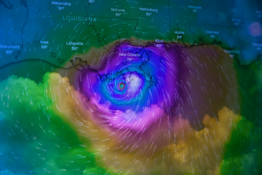
Featured image is representational and shows Hurricane Ida, not Cyclone Murasu. Photo: Brian McGowan / Unsplash.